GOLD RUSH – THE DUNSTAN TRACK Part. 1
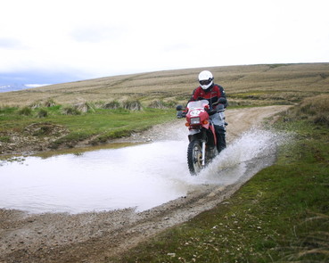 Track surface is mostly gravel, but beware the occasional rutted section.
The sun belts down from a cloudless sky, golden tussocks wave in the hot summer breeze. The air is dry, the ground baked, and not a sign of human habitation. A ribbon of twisting gravel is the only reminder that in the 1860s this quiet track was the road of dreams for thousands of the hopefuls of the Central Otago gold rush.
Tens of thousands flocked to Dunedin from other parts of New Zealand, Australia, Britain, California and China. All the talk was of Dunstan gold. With no recognizable roads inland the miners first fanned out over the big broad ridges to the Dunstan (now called Clyde) goldfields, but as the carters with their bullock teams and all the hangers-on of the colonial gold rush pushed west a road of sorts was formed. They called it the Dunstan Trail.
Tens of thousands flocked to Dunedin from other parts of New Zealand, Australia, Britain, California and China. All the talk was of Dunstan gold. With no recognizable roads inland the miners first fanned out over the big broad ridges to the Dunstan (now called Clyde) goldfields, but as the carters with their bullock teams and all the hangers-on of the colonial gold rush pushed west a road of sorts was formed. They called it the Dunstan Trail.
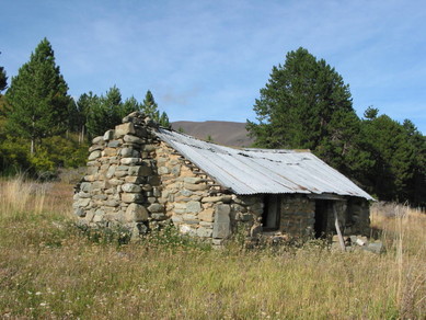 A legacy of extensive pastoral farming and gold mining has given ‘Central’ a rich history.
The Dunstan Track is a legal road and can still be followed in summer over most of the original route from Dunedin to Clyde. For the most part, unlike many other historic highways, it’s not paved over and still passes through terrain almost as empty and desolate as it was a century and a half ago. The track is still very remote and exposed and is closed in winter, but makes a good Adventure ride in settled weather. As this is long ride, about 180 km in total from Dunedin to Clyde, I have split the route into two track guides. Section one deals with the ride from Dunedin to Paerau, where you can if needed bail out on the seal towards Ranfurly. Section two describes the Paerau to Clyde section.
The ride from Mosgiel follows tar sealed highway 87 as it quickly leaves the city behind in a flowing climb over the Maungatua Hills. The Dunstan Rd turns off west at Clarks Junction, but despite the promise of higher country ahead it first drops to Deep Stream, turning to reasonably good gravel before the climb around the northern end of the Lammermoor Range, and on to the modestly named (but 1000m high), Rough Ridge.
By now the scale and remoteness of the landscape will be apparent. The country here still attracts plenty of rain, draning into the Great Moss Swamp, seen to the west, looking more like the lake that it has become since becoming part of the Taieri Irrigation scheme. As you climb further over the Rock and Pillar Range you can sense the climate becoming drier.
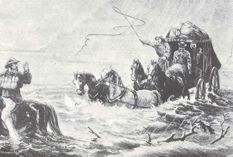
Luxury land travel in the 1860s. As all the hangers-on of the colonial gold rush pushed west the Dunstan Trail was formed.
Stopping above the last winding descent to Paerau, the Serpentine Flats of the Upper Taieri River are laid out below, while further to the west, across the valley, the Dunstan Trail begins its next climb over Rough Ridge and the next 100 km of the journey to Dunstan, to be detailed in part two.
ISSUES
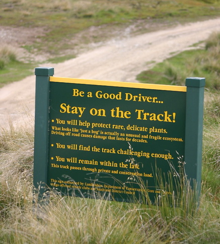 Don’t be part of the problem.
Over the last few years inappropriate use by some 4x4 and bike users have caused much damage to tracks and wetlands in Otago. Tracks that served farmers and recreationists well over decades in dry weather have been hit hard in recent years by heavy use in wet and frosty weather. In places over-tyred 4x4 vehicles have ground massive ruts, while dirt bikes have chewed through wetlands, seemingly just for the hell of it. Greens are now putting pressure on DOC to shut this country down to all vehicle users. Adventurer riders, please take heed, use only the legal tracks, use them responsibly and only in dry weather.
ROUTE INSTRUCTIONS
| dunstan_1_route_inst..pdf |