The 16 km Porika Track is one of the classic South Island Adventure rides.
The Porika Track is one of the classic South Island Adventure rides.
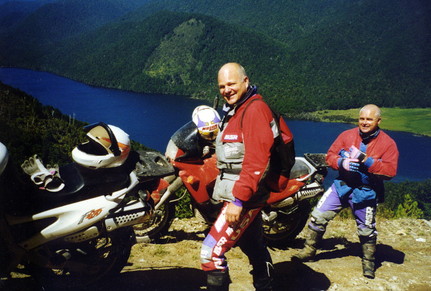
New Zealand’s South Island is an Adventure rider’s paradise with many partly made back country roads open to the public, in suitable conditions. The 16 km Porika Track is one of the classic South Island Adventure rides and makes a magnificent scenic gateway through the Nelson lakes National Park and into the Buller region.
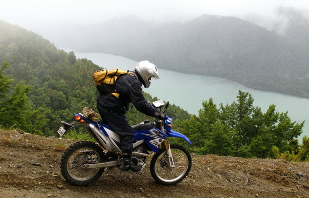
The track climbs from near St Arnaud through native beech forest and past old gold workings before dropping steeply to lake Rotoroa, with splendid views of the lake and the Braeburn and Travers Ranges.
This is a challenging route on a large Adventure bike, especially so with a passenger, as there are steep sections and hairpin turns on the Rotoroa side. How you tackle the ride depends on whether you prefer the challenge going up, or down. The surface is mainly gravel or natural stone, with clay exposed on the steeper sections, which does become slippery after rain. The track is well used by 4x4s, mountain bikes and motorcycles, so caution is advised.
The 16 km Porika Stock Route was upgraded to support the West Coast extension to the national power grid.
This is an historic route too, as in 1846, explorers Spooner, Brunner, Fox and Heaphy (all later to become famous colonists) were shown the Porika Route by their guide Kehu. Maori had of course used the Porika for generations as part of the route from the Wairau to the greenstone grounds on the West Coast. Only a year the colonial explorers in 1846 a cart road was pushed up to the St Arnaud area from Nelson, though this was still a six day journey for wagons. Later the Porika Track was in use as a stock route into the Buller region to support the gold and timber booms.
The 16 km Porika Stock Route was upgraded to support the West Coast extension to the national power grid, the pylons for which do not intrude unduly. The Nelson Lakes National Park, which largely surrounds the track, was formed in 1956 and covers 96,121 hectares.
The enigmatic Raymond Gibson, the self proclaimed Bard of the Bush, lived on the side of the track in a shack near the gold workings. Anyone stopping was ambushed and offered a cup of tea and an hour of two of his poetry, the notes for which were extracted from ancient biscuit tins stacked around the walls of the hut. Sadly the Bard of the Bush himself has passed into legend, but the hut site is marked with a substantial stone cairn.
This route guide begins at St Arnaud where there is accommodation, fuel and food and finishes at Lake Rotoroa (no fuel of food). Rotoroa is accessed by sealed road from Gowanbridge on SH 6. Extensions to this route are the Braeburn and Maruia tracks, which I will cover in future pages.
Download the route sheet below.
Please note that due to my long suspected dyslexia I have made a blunder in these route notes as pointed out in this note from a rider. " In your info sheet relating to the Porika Track you have the Howard Valley Road turning off route 83 – it should read route 63. Poor editing, needs correcting." Thanks for that Jean Richards, I hope you enjoyed the ride despite the error.
| porika_route_sheet.pdf |